Louisiana is a state in the southern USA, located east of Texas and west of Mississippi. Its capital city is Baton Rouge, while its largest city and metropolitan area is New Orleans.
Unlike other US states, Louisiana is not divided into counties, but rather "parishes", a term originally used for church administrative areas.
It's not easy to find a combined city and parish map of Louisiana. But I found a couple that were helpful to me. The first one is a road map that shows the cities and parishes of Louisiana in great detail.

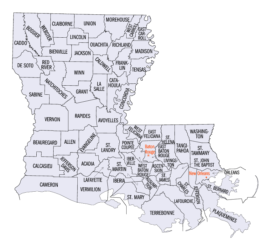
The second one shows the parishes of Louisiana, but only the major cities. This is useful if you're more interested in the general picture.
I hope you found these city and parish map of Louisiana helpful. If you can find a better one, please let me know and I'll add it to this collection.